Show the map
Col du Mont Tournier - Mont Chaffaron - Col de la Lattaz
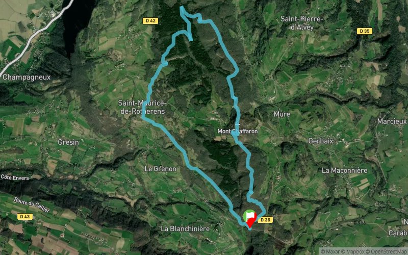


13.1 km
590 m
590 m
 Sainte-Marie-d’Alvey (73)
Très beau parcours en partie balisé mais toujours avec un sentier bien présent. De très beaux points de vue notamment sur la Dent du chat, le massif de l'Epine, le Lac d'Aiguebelette, le Lac de Paladru et la Chartreuse... Ne ratez pas les 2 points de vue après le col du Mont Tournier et juste avant la descente finale.
Points of Interest table
| Accum. | Intermediary | |||||||
|---|---|---|---|---|---|---|---|---|
| POI | Description | Alt. | Dist. | D+ | D- | Dist. | D+ | D- |
Trace n°134214
Ascent threshold : 3 m Distance threshold : 30 m Smoothing : Yes Origin of altitudes : MNT Aster GDEM
Ascent threshold : 3 m Distance threshold : 30 m Smoothing : Yes Origin of altitudes : MNT Aster GDEM
Loop
Dominant terrain : Footpath
Max alti. : 863 m
Avg alti. : 712 m
Min alti. : 534 m
Longest ascent : 270 m
Longest descent : 340 m
Route completed by the author : Yes
Dominant terrain : Footpath
Max alti. : 863 m
Avg alti. : 712 m
Min alti. : 534 m
Longest ascent : 270 m
Longest descent : 340 m
Route completed by the author : Yes
Elevation profile
More tools
Create a new roadbook page
Map and track on your website
Warning ! When you insert a Trace de Trail map on your website, you agree not to hide any element of the module (links to Trail Trail or Trail Connect banner)
Add a realisation
Validate
Add a realisation to share your chrono and describe the conditions that you encountered during you trail running !
Add a comment
Validate
Show the infos
Add a track