Show the map
Les Pettoreaux - Mon Joux - Mont d'Arbois
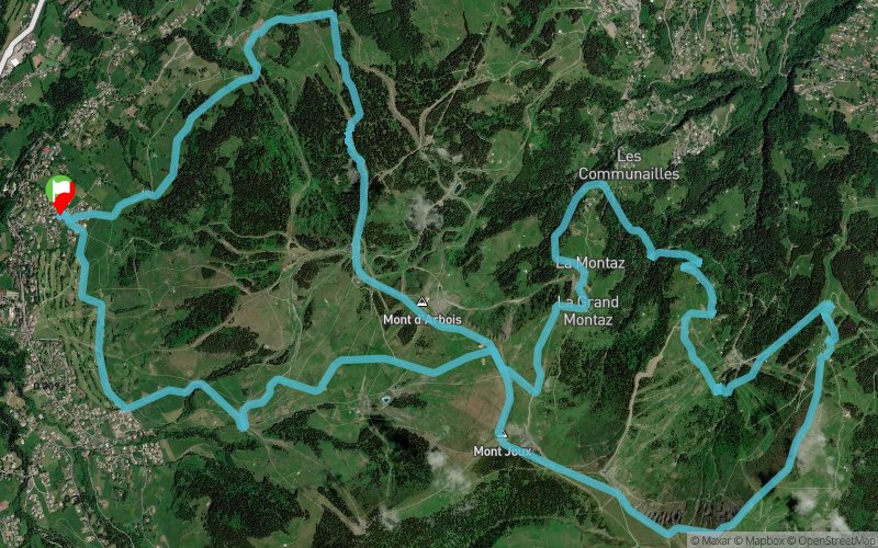


22.8 km
1380 m
1380 m
 Demi-Quartier (74)
 Points of Interest table
| Accum. | Intermediary | |||||||
|---|---|---|---|---|---|---|---|---|
| POI | Description | Alt. | Dist. | D+ | D- | Dist. | D+ | D- |
Trace n°166446
Ascent threshold : 3 m Distance threshold : 30 m Smoothing : Yes Origin of altitudes : MNT Aster GDEM
Ascent threshold : 3 m Distance threshold : 30 m Smoothing : Yes Origin of altitudes : MNT Aster GDEM
Loop
Dominant terrain : Path
Max alti. : 2004 m
Avg alti. : 1608 m
Min alti. : 1284 m
Longest ascent : 790 m
Longest descent : 590 m
Route completed by the author : Yes
Dominant terrain : Path
Max alti. : 2004 m
Avg alti. : 1608 m
Min alti. : 1284 m
Longest ascent : 790 m
Longest descent : 590 m
Route completed by the author : Yes
Elevation profile
More tools
Create a new roadbook page
Map and track on your website
Warning ! When you insert a Trace de Trail map on your website, you agree not to hide any element of the module (links to Trail Trail or Trail Connect banner)
Add a realisation
Validate
Add a realisation to share your chrono and describe the conditions that you encountered during you trail running !
Add a comment
Validate
uba74
19/11/21, 16:50:47
Le parcours traverse quelques paturages hors sentier. Eviter ces portions de Mai à Octobre
19/11/21, 16:50:47
Le parcours traverse quelques paturages hors sentier. Eviter ces portions de Mai à Octobre
Show the infos
Add a track